Back to Projects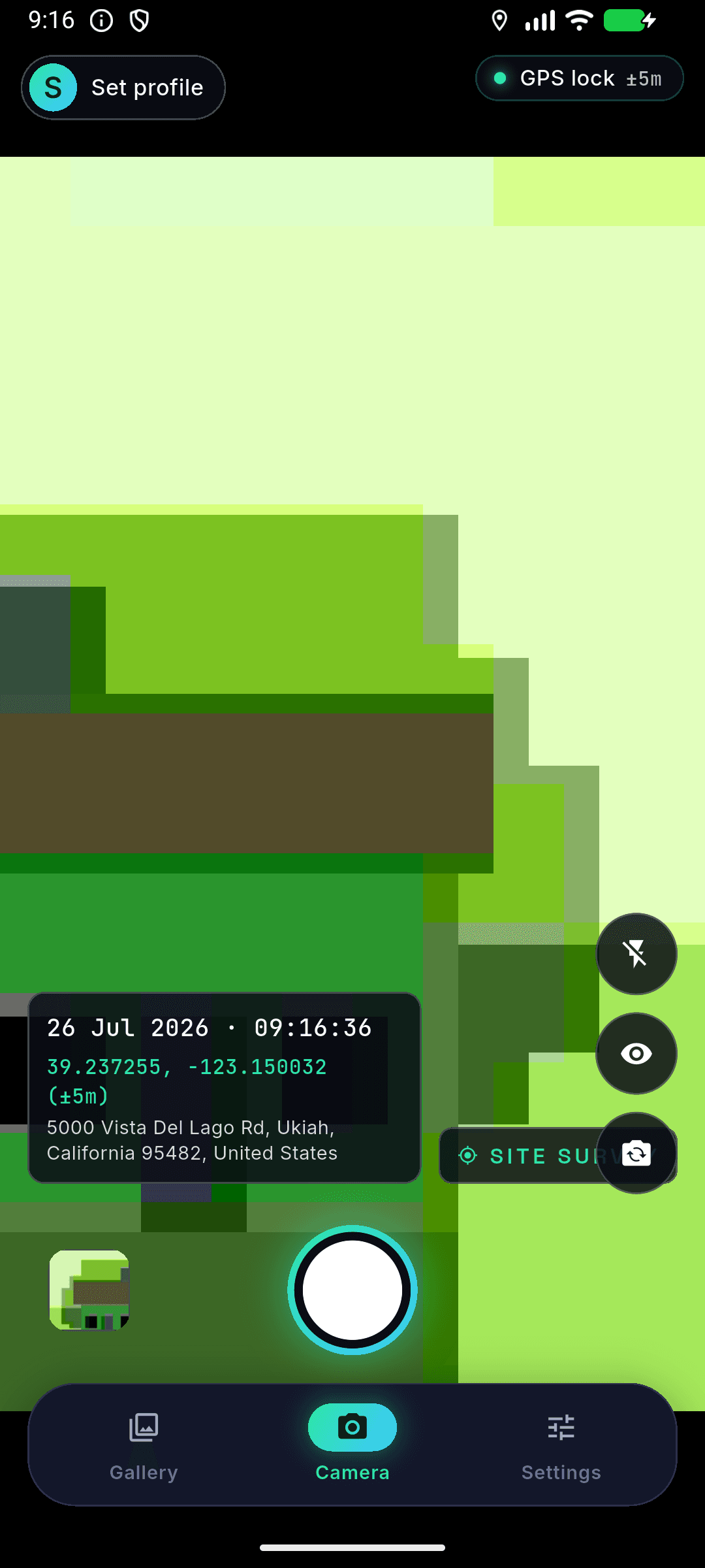
Mobile AppPlatform: Flutter Cross-Platform
Site Survey Camera App
Flutter mobile app with GPS overlays & Instagram-style annotations
Site Survey is a robust Flutter mobile application engineered for field survey work, site inspection, and civil audit logging. Photos captured with the app are automatically stamped with permanent, tamper-proof HUD overlays displaying live high-precision GPS coordinates, reverse-geocoded physical address, timestamp, and company watermarks. Immediately after capture, an interactive canvas editor allows engineers to add Instagram-style text annotations. All captures are stored in a local SQLite database, powering full-text search across annotations, addresses, and dates.
// Interface Showcase (1 of 5)
Select Screen View:
// Key Technical Highlights
- Live Camera HUD with real-time GPS coordinates, timestamp & watermark
- Post-capture canvas editor with draggable, resizable text annotations
- Image flattening pipeline preserving metadata in local SQLite database
- Searchable gallery supporting instant queries on annotation text & address
- Customizable engineer profiles, branding logos, and GPS precision settings
// Technologies Used
FlutterDartSQLiteGPS & Maps APICanvas / Image ProcessingMobile App
// Built with precision by The Stupid Devs.
Start Your Project →